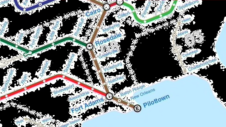
Mark Twain spent his early years navigating America's winding waterways, but the steamboat pilot-turned-author was also a fan of modern transportation: He was one of the first passengers to ride the London Underground's longest tube line—the Central Line—when it first opened in 1900. Needless to say, Twain would probably be a fan of the map below, which visualizes U.S. rivers as subway lines.


Created by graphic designer Theo Rindos (and spotted by CityLab), the map is inspired by Harry Beck's original London Tube map from the 1930s. It's based on data culled from the U.S. Geological Survey, Google Maps, and Wikipedia.
"I have always been fascinated by transit maps and river systems, and I thought, 'Why not put them together?'" Rindos tells Mental Floss. Beck's design style "has been kind of a staple for many city transit systems because it's so easy to understand and is so beautiful. The rivers of the United States are complex, and I wanted to see if I could achieve a similar outcome."
The source of each river is denoted with a solid-colored circle. White circles indicate where these waterways converge and split, and neighboring cities and towns are marked as "stations." That said, the map doesn't feature every single U.S. river: It includes ones important to the transportation and shipping sectors, but for aesthetic reasons, Rindos opted to leave out awkwardly shaped rivers and turned smaller ones into bus routes.
You can purchase Rindos' map here, or visit the designer's website to learn more about his work.
[h/t CityLab]
