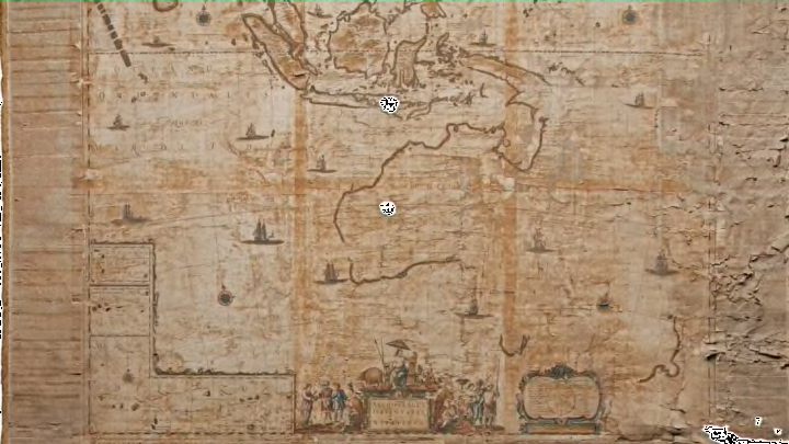
More than 40 years before Captain James Cook landed on Australia’s eastern coast in 1770, renowned Dutch cartographer Joan Blaeu created an early map of the Land Down Under. Using geographical information gleaned from Dutch navigator Abel Tasman in the 1640s, it was the first map to include the island state of Tasmania and name New Zealand, and the only one to call Australia “Nova Hollandia.”
Very few copies—if any—of the 1659 map, titled Archipelagus Orientalis (Eastern Archipelago), were thought to have survived. But in 2010, a printing was discovered in a Swedish attic. After being restored, the artifact is newly on display at the National Library of Australia, in the capital city of Canberra, according to news.com.au.
The seller’s identity has been kept under wraps, but it’s thought that the map belonged to an antiquarian bookseller who closed his or her business in the 1950s. For decades, the map sat amidst other papers and books until it was unearthed in 2010 and put up for auction.
The National Library acquired the 17th century wall map in 2013 for approximately $460,000. After a lengthy restoration process, it recently went on display in its Treasures Gallery, where it will hang until mid-2018.
As for other surviving copies of the map: a second version was discovered in a private Italian home and announced in May 2017, according to Australian Geographic. It ended up selling for more than $320,000.
[h/t news.com.au]
