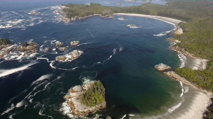
The prehistoric mariners rowed their canoe into a secluded channel and then onto the island's sandy beach, just above the high-tide mark. One person got out of the boat and stood for a moment, facing northwest. Others, including another barefoot adult and child, followed the leader and walked toward higher, drier land.
Today, roughly 13,000 years later, their footprints have been preserved in a layer of sediment and confirmed to date from the last ice age. The discovery, on Calvert Island on the central coast of British Columbia, Canada, adds to the growing body of evidence that suggests ancient humans crossed from Asia to North America and traveled south along the Pacific shoreline.
"This finding provides evidence of the seafaring people who inhabited this area during the tail end of the last major ice age," said University of Victoria anthropologist Duncan McLaren, lead author of the new study in the journal , in a statement.

Most anthropologists believe that early peoples migrated from Asia to North America across Beringia, the region where Russia's Chukchi Peninsula and Alaska face each other across the Bering Strait. Then the migrants took two possible routes. One popular theory, proposed in the 1930s, suggests people traveled south along an ice-free corridor that lay on the eastern slope of the Rocky Mountains where two colossal ice sheets split from one other. A more recent theory proposes that they sailed along a coastal route from Alaska to Washington State.
The coastal route lies within the territories of the Heiltsuk First Nation and Wuikinuxv First Nation. Their oral histories describe how the scattered islands between the open ocean and the edge of the ice sheet remained unglaciated. On these refuges, their ancestors subsisted on the abundant fish, shellfish, and marine mammals and likely used watercraft to travel between the islands. "Heiltsuk oral history talks about our people living in our territory before the ice age, and talks about the physical features of the landscape that our people witnessed change over time due to the ice, which influenced things like place names in our territory," William Housty, chair of the Heiltsuk Integrated Resource Management Department board of directors, tells Mental Floss.
Archaeological evidence affirming the histories is scarce, in part because few researchers have focused on the area. In 2014, McLaren and colleagues from the University of Victoria and the Hakai Institute, along with representatives of the First Nations, began combing the beach at a Calvert Island site called EjTa-4 for sediments dating back to the late Pleistocene epoch (also known as the Ice Age, which ended 11,700 years ago). Back then, the sea level around Calvert Island was 6.5 to 10 feet lower than it is today, so the team concentrated on the intertidal zone. After probing several test holes, they found what appeared to be footprints near the base of a huge shell midden.

Over the next three field seasons, they continued to excavate a 6.5-foot-by-13-foot pit, removing strata of sand, pebbles, and organic matter before striking the layer of clay. "The site was below the high-tide water line, so we only had one day from the time we opened the last layer. When the high tide came up it would wash everything away," Jennifer Walkus, the research liaison between the Wuikinuxv Nation and Hakai Institute, tells Mental Floss. "We had an idea from the test pit the previous year that there might be footprints, so we knew that day was going to be busy. It was amazing as the last layer was pulled up and the measurements were taken."
In the substrate, the team found 29 individual human tracks, darkened by time, left by at least three different people—two adults and a child—based on the dimensions of the individual prints. "The fact that they were footprints was more and more obvious as the measurements came in and there were three lengths," Wallkus says. The orientation of some of the tracks at the ancient shoreline indicated that a group of people may have disembarked from a watercraft and walked northwest, toward higher ground, with their backs to the prevailing wind.
Researchers also collected samples of clay and fragments of shore pine from the sand underneath the prints. Radiocarbon dating confirmed that the pine bits, and the footprints, were between 13,317 and 12,633 years old.
"I can't speak for the Nation as a whole, but for me, it's a validation of the fact that we have been here for much longer than the previous narrative," Walkus says. "The fact that these footprints put people in the vicinity in the time of glacial recession underlines that our legends are grounded in living in our area over huge spans of time."
When William Housty, who was not present at the dig, heard of the discovery, "I immediately started to think about our first ancestors and the stories of their origin," he says. "I also thought that, once again, science [and] archeology have confirmed what our oral history has been telling us all along."
