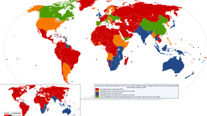
Two maps in one! The smaller map is a quick and dirty look at where people drive on the left (blue) and where people drive on the right (red). But the larger map gives a little more context. Here's the key:

Though not a hard and fast rule, places that were under French and U.S. influence kept right, while those under the British Empire and its influence stayed left. Back when Samoa went lefty on us in 2009, Linda Rodriguez-McRobbie looked into how countries choose which side they drive on.
The Afternoon Map is a semi-regular feature in which we post maps and infographics. In the afternoon. Semi-regularly. Thanks to NuclearVacuum for creating this one, which we found via Wikimedia Commons.
