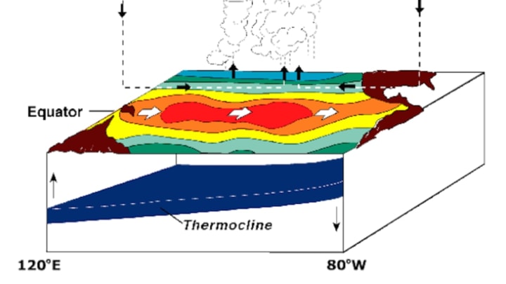
Climate models are predicting that this fall, there's a 75 percent chance that an El Niño will occur. But just what is this phenomenon, and how does it affect us?
At its simplest, El Niño refers to unusually warm water temperature in the Pacific Ocean near the equator, and the ensuing weather and climate effects that warm water causes. During an El Niño, the surface temperature of the water is generally 1.5 degrees to 2.5 degrees Celsius above average. (This is the opposite of La Niña, which is characterized by unusually cool temperatures.) The natural phenomenon occurs at random intervals of 2 to 7 years and can last anywhere from nine months to a year—although in extreme circumstances, El Niños have lasted several years.
The slight rise in water temperature has wide ranging effects in weather across the globe. El Niño episodes are associated with increased rainfall across the east-central and eastern Pacific, including the west coasts of North and South America, and with drier-than-normal conditions over northern Australia, Indonesia, and the Philippines. Most of the affected areas will also experience warmer-than-normal winters during El Niño.
The normal wind conditions and atmospheric pressure conditions over the Pacific Ocean are responsible for the regular upwelling of cooler, nutrient-rich water off the coast of South America, which sustains a large fish population. During El Niño, the changes in pressure and wind patterns reduce this upwelling and, in turn, result in a decreased fish population. At least as much as the weather—which can often include dangerous flooding—this effect on the fishing economy is one of the more devastating impacts of El Niño.
Though we last saw an El Niño in 2004, the strongest El Niño in recent history occurred in 1997-'98 [PDF]. According to the National Oceanic and Atmospheric Administration (NOAA), water temperatures along the west coast of South America were 4 degrees Celsius above average, which resulted in extreme weather patterns across the U.S. The span from December to February was the second warmest and seventh wettest since 1895. Several states saw flooding, while the Northeast was hit with an ice storm and Florida experienced an unusually high number of tornadoes. This predicted El Niño could be similarly bad: NASA climatologist Bill Patzert said that "a pattern of sea surface heights and temperatures has formed that reminds me of the way the Pacific looked in the spring of 1997." For more on the science behind El Niño, check out NASA's ScienceCast, below.
