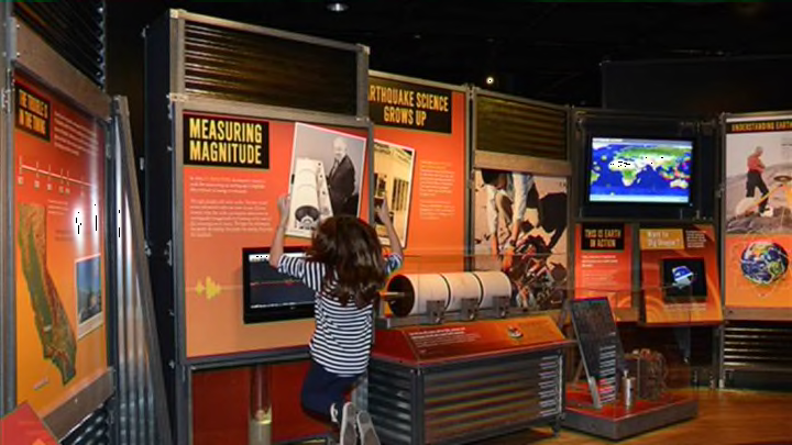
This weekend, the American Museum of Natural History opens its latest exhibition, Nature’s Fury: The Science of Natural Disasters. Originally created by the Field Museum, the exhibition looks at earthquakes, volcanoes, tsunamis, hurricanes, and tornadoes, and has been updated with a New York angle: Visitors will be able to see an interactive table displaying the effect of and response to Hurricane Sandy, step inside a tornado, and create a virtual volcano. Here are a few things we learned from a preview visit.
1. You might believe that tornadoes can’t cross rivers, or that they can't occur in big cities—but both are myths!
2. At magnitude 9.3, the December 26, 2004 earthquake that caused the devastating Indian Ocean tsunami was one of the most powerful earthquakes ever measured: It caused the entire planet to vibrate up to half an inch.
3. When Mount St. Helens erupted in on May 18, 1980, it released 520 million tons of ash; the ash cloud spread halfway across the U.S. in just 24 hours.
4. Hurricanes, tropical cyclones, and typhoons are all the same thing. The word hurricane comes from the name of an evil god for ancient Caribbean peoples, Hurican. They took the name from the Ancient Maya’s god of wind and storm, Hurakan.
5. On average, there are 1300 tornadoes a year in the United States, and just 63 in Canada.
6. Krakatoa, which erupted on May 27, 1883, sent a cloud of ash and gas 30 miles into the sky, affecting weather globally. The eruption may have influenced a very famous painting: Edvard Munch’s The Scream (1893). Volcanic aerosols reflect light in a way that produces red sunsets; the red skies in Munch’s painting may be a portrayal of the twilights seen in Norway for months after the volcano erupted.
7. The longest-lasting tropical cyclone was Hurricane Ginger, which lasted for 28 days in the fall of 1971.
8. During the strongest of the New Madrid earthquakes—which occurred along a fault line in the middle of the North Atlantic plate in 1811 and 1812—shaking could be felt across 2 million square miles.
9. The earliest known seismometer was invented in China in A.D. 132. The device looked like a jar on a table, and was adorned with eight dragon heads and eight toads. Shaking would cause a ball to fall from a dragon’s mouth into a toad’s, revealing the direction of the earthquake’s waves.
10. The epicenter of an earthquake is on the surface; it sits above the hypocenter, the place underground where a fault ruptures.
11. Tornadoes can be rated F0 through F5, according to the damage they may cause. The F stands for Fujita, the last name of the researcher who came up with the scale in 1971. In 2007, scientists started using a new, more precise system, called the Enhanced Fujita Scale, which accounts for variables like the types of buildings and their construction.
All images courtesy of the American Museum of Natural History.
