As part of her graduate studies in NYU's Interactive Telecommunications Program, Michelle Chandra has found a way to make all those sunset photos on Instagram even more beautiful.
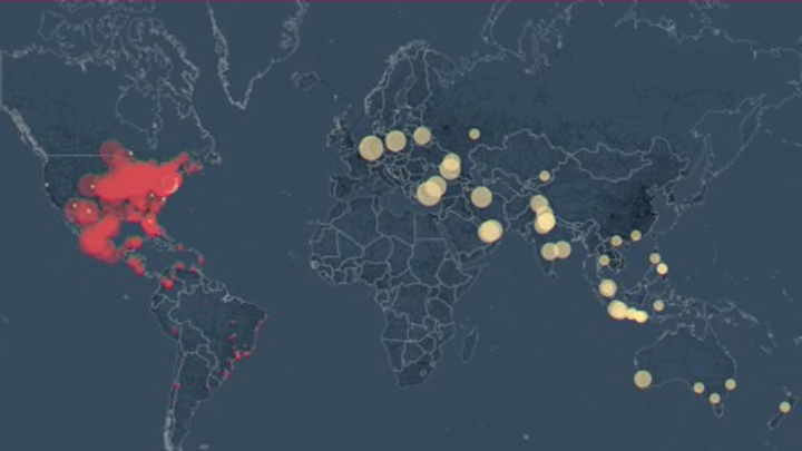
Chandra has created a map visualization called “All Our Suns,” which gorgeously illustrates photos tagged #sunrise and #sunset in real time across the globe. The data is all from photos posted to Instagram in the past 24 hours.
Red dots indicate sunset photos from zero to six hours after the event, while sunrises (in yellow dots) get a little more lag time—zero to 18 hours—as users tend to wait a little while to upload their documentation of an early morning. (As you might imagine, there tend to be fewer sunrise posts in general.) The closer someone is to the actual time of sunset or sunrise when they upload, the larger their point will be on the map.
The dots move across the map from right to left (east to west) offering a whole different way of seeing the path of the sun. Another map shows all sunset or sunrise photos uploaded to Instagram in the past day, and you can hover over a point to see the actual photograph, or type in a specific destination—say, the Empire State Building—to get many different glimpses of a particular place.
For more on how and when we upload the sun, take a spin around Chandra’s site.
