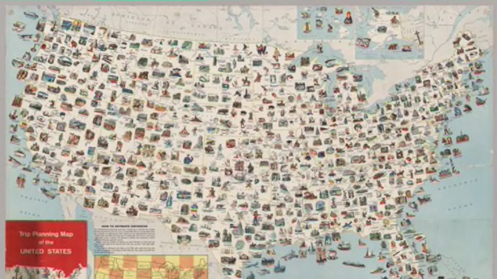
Since the advent of the automobile at the turn of the 20th century, Americans have been hitting the open road in search of new horizons and giant balls of twine. For adventurous road-trippers of the 1960s, this map produced by General Drafting would have been their ultimate guide.
The vintage map from 1962 is filled with full-color illustrations of landmarks and products from each of the fifty states. Missouri is identified as home to quail hunting and mineral water, while North Carolina is the producer of cigarettes, furniture, and mountain handicrafts.

Courtesy of the David Rumsey Map Collection
It also includes a smaller checkerboard map meant to help travelers gauge their driving times. The side of each square is 360 miles, the equivalent of about a day’s drive without time set aside for sightseeing.

Courtesy of the David Rumsey Map Collection
The map publisher, General Drafting, originally made the guide to be sold or freely distributed at service stations across the country. Though a handful of the stops are dated (the Circus Hall of Fame has moved from Florida to Indiana; the Prehistoric Indian Burial Pits in Kansas have been closed), most of them, like the national parks, can still be visited today. Prints can be purchased online for travel nerds to hang on their walls at home—or to fold up and keep in their glove compartments.
[h/t: Vox]
