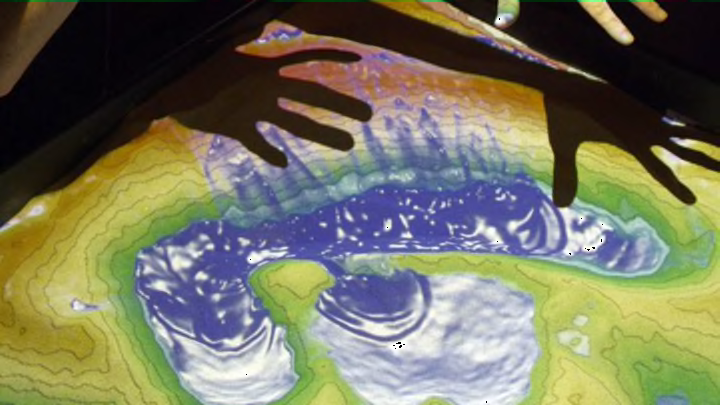
Gone are the days of painstakingly chipping away at a chunk of green styrofoam or gluing layer upon layer of cardboard together to create the perfect topographical map for your final science project. Now, students at UCLA can use a high-tech sandbox to recreate topographical maps and simulate how erosion and weather events change landscapes over time.
According to a UCLA news announcement, the technology for the Augmented Reality Sandbox (as the fancy toy—ahem, research tool—is called) was first developed by researchers at the University of California, Davis. UCLA’s version was built by a team headed by Gary Glesener, director of UCLA’s Modeling and Educational Demonstrations Laboratory.
Glesener and his team started with an actual playground sandbox. This sandbox was then connected to an Xbox Kinect sensor, which picks up any changes students make to the sand as they create their mountains and valleys. The changes are processed with open source software and projected in pretty colors onto the sandbox below. In addition to sculpting the sand into geographical formations, students can also hover their hands over the box to make it rain in designated areas.
In the above video demonstration of the AR sandbox released by UCLA, Glesener explains how the new tool can help students even when they leave the classroom. “When students are out in the field and they don’t have a sandbox to recreate what they have on the map, they can recreate it in their head," he says. "They can build a mental model to identify where they’re at, identify certain features in the area.”
