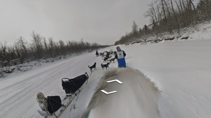
While many of us are familiar with dog sled racing thanks to classic books like Stone Fox and Winterdance, few people have had the opportunity to see what life actually looks like on the trail during the sport's most famous race, the Iditarod in Alaska, until now. As Jalopnik reports, Google—with the help of former Iditarod winner Dean Osmar—has created a way for anyone with an Internet connection to view the day-to-day experiences of a musher during the 1049-mile long race.
By developing a special Street View Trekker for Osmar to wear on his back, Google effectively turned the man into one of its Street View vehicles for the 2015 race. According to TechCrunch, there were a few hiccups during the trip, as Osmar was forced to deal with poor weather conditions and several sled crashes. The Iditarod Google Street View website created for the project includes a gallery of screenshots taken at various points in the race, with each image linking back to a point on the map that viewers can dive into and explore. Some of the shots are blurred, while others show just the ground or runaway sleds, but those add a bit of authenticity to the project.
Check out a few of the images below, and click through to the Street View site for more.


Images via Iditarod Google Street View
[h/t Jalopnik]
