%20%20--%3E%0A%3Csvg%20version%3D%221.1%22%20id%3D%22Layer_1%22%20xmlns%3D%22http%3A%2F%2Fwww.w3.org%2F2000%2Fsvg%22%20xmlns%3Axlink%3D%22http%3A%2F%2Fwww.w3.org%2F1999%2Fxlink%22%20x%3D%220px%22%20y%3D%220px%22%0A%09%20viewBox%3D%220%200%20684.6%2068.1%22%20style%3D%22enable-background%3Anew%200%200%20684.6%2068.1%3B%22%20xml%3Aspace%3D%22preserve%22%3E%0A%3Cg%3E%0A%09%3Cpath%20d%3D%22M444.1%2C29.3h-17.4v14.5h17.4V29.3z%20M36.4%2C68.1l29.3-50.8V0H50.4L32.9%2C36.8L15.5%2C0H0v68.1h16.7V45.8l12.4%2C22.3H36.4z%0A%09%09%20M49.1%2C68.1h16.6V23.4L49.1%2C52.1V68.1z%20M76.6%2C68.1h45V53.8H93.3V41.6h21V27.1h-21V14.8h28.3V0.1h-45V68.1z%20M175.6%2C68.1h17.3v-68%0A%09%09h-16.5v40.3L150%2C0.1h-17.6v68h16.7V27.7L175.6%2C68.1z%20M235.8%2C14.8h15.4V0.1h-47.4v14.7H219v53.2h16.8V14.8z%20M290.3%2C45.9h-17.1%0A%09%09l7.5-15.6h2L290.3%2C45.9z%20M298.7%2C68.1h18l-32.2-68h-5.7l-32%2C68h18l3.3-7.1h27.1L298.7%2C68.1z%20M325.2%2C68.1h46.2V53.8h-29.6V0.1h-16.7%0A%09%09V68.1z%20M423.7%2C14.8h27.2V0.1H407v68h16.7V14.8z%20M462%2C68.1h46.2V53.8h-29.6V0.1H462V68.1z%20M564.8%2C34.1c0%2C10.7-7.2%2C19.2-18.5%2C19.2%0A%09%09c-11.4%2C0-18.5-8.5-18.5-19.2s7.1-19.2%2C18.5-19.2C557.6%2C14.9%2C564.8%2C23.4%2C564.8%2C34.1%20M580.6%2C34.1c0-19-14.2-34-34.3-34%0A%09%09c-20.2%2C0-34.3%2C15-34.3%2C34c0%2C19%2C14.1%2C34%2C34.3%2C34C566.4%2C68.1%2C580.6%2C53.1%2C580.6%2C34.1%20M604.8%2C20.5c0-4.1%2C3.3-6.2%2C6.7-6.2%0A%09%09c4.4%2C0%2C6.6%2C3%2C6.6%2C6.6h14.7C631.8%2C9.1%2C625.1%2C0.1%2C611%2C0.1c-12%2C0-21.7%2C9.3-21.7%2C20.6c0%2C10.9%2C5.9%2C15.9%2C16.7%2C19.8%0A%09%09c5.2%2C1.8%2C11.5%2C3.2%2C11.5%2C8c0%2C3.3-2.4%2C5.5-6.4%2C5.5c-3.6%2C0-6.6-3-6.6-6.7h-15.2c0%2C11.5%2C7.9%2C20.8%2C21.8%2C20.8c12%2C0%2C21.6-9.3%2C21.6-20.6%0A%09%09c0-10-5.3-16.4-16.7-19.8C610.6%2C26.1%2C604.8%2C25.3%2C604.8%2C20.5%20M670%2C20.9h14.7C683.8%2C9.1%2C677.1%2C0.1%2C663%2C0.1c-12%2C0-21.7%2C9.3-21.7%2C20.6%0A%09%09c0%2C10.9%2C5.9%2C15.9%2C16.7%2C19.8c5.2%2C1.8%2C11.5%2C3.2%2C11.5%2C8c0%2C3.3-2.4%2C5.5-6.4%2C5.5c-3.6%2C0-6.6-3-6.6-6.7h-15.2c0%2C11.5%2C7.9%2C20.8%2C21.8%2C20.8%0A%09%09c12%2C0%2C21.6-9.3%2C21.6-20.6c0-10-5.3-16.4-16.7-19.8c-5.4-1.6-11.3-2.4-11.3-7.2c0-4.1%2C3.3-6.2%2C6.7-6.2C667.7%2C14.4%2C670%2C17.3%2C670%2C20.9%0A%09%09%22%2F%3E%0A%3C%2Fg%3E%0A%3C%2Fsvg%3E%0A)

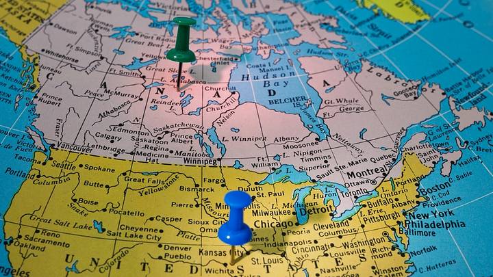
If you look at a map of North America, the border between the U.S. and Canada looks fairly straightforward. Although it’s a bit squiggly along the eastern half, there’s a remarkably straight section running between Boundary Bay in Washington State and British Columbia and the Lake of the Woods in Minnesota and Manitoba. But on closer inspection, the dividing line between the two countries—which at 5,525 miles, is the longest border shared by two countries in the world—actually has a few anomalies.
The U.S.-Canadian border was largely mapped out during the 18th and 19th centuries without the aid of modern technology, so it was a boots-on-the-ground job. Although the teams did the best they could, human error led to the line—which is marked by a 20-foot strip of cleared land known as The Slash—including a few peculiarities. From islands that are cut off to towns that have been cut in half, here are six strange areas along the border between the U.S. and Canada.
- Point Roberts
- Haskell Free Library and Opera House
- East Richford Slide Road
- The Northwest Angle
- Akwesasne
- Campobello Island
Point Roberts

When the boundary along the 49th parallel was extended in 1846, no one initially realized that it cut off Point Roberts from mainland America. The little peninsula—it’s just 5 square miles—is attached to Canada, but it dangles just south of the 49th parallel, placing it on America’s side of the line. This makes Point Roberts an exclave—that is, a region that is geographically separate from the main part of a territory.
Point Roberts is surrounded by the Strait of Georgia to the south and west and by Boundary Bay to the east. Since many of the roughly 1,000 people who live on the peninsula year-round work or go to school in mainland Washington State, their commute has to go through Canada’s British Columbia. Although they’re only on Canadian soil for 25 miles, getting there and back again involves four international border crossings.
Haskell Free Library and Opera House

Although much of the U.S.-Canadian border cuts through wilderness, there are some towns and even buildings that straddle the dividing line. One such building is the Haskell Free Library and Opera House, which sits on the boundary between Stanstead, Quebec, and Derby Line, Vermont.
Opened in 1904, the library's entrance is on the American side, but most of the books are shelved in Canada. As for the opera house, the seats are largely in America, while the stage is in Canada. There’s even a black line running along the floor so that visitors know exactly where the border is.
For decades, Canadian patrons were allowed to cross the border without checks in order to enter via the entrance in America (although all visitors were advised to have suitable ID on hand in case U.S. Border Patrol or the RCMP stopped by). That changed in 2025, with tighter regulations meaning that Canadians could no longer freely cross the border. But the library’s management wasn’t deterred. “The mission was to unite both communities and both countries and we’re going to still do that,” said Sylvie Boudreau, Haskell Free Library board president. A fundraising campaign was launched and the emergency exit on the Canadian side has now been turned into a proper entrance.
East Richford Slide Road
Another border oddity in Vermont—less than an hour’s drive west from Haskell Free Library—is East Richford Slide Road. The vast majority of roads between America and Canada are policed by border control, but East Richford Slide Road gets a pass. That’s because the northern Vermont road only crosses into Quebec for roughly a tenth of a mile before passing back into the United States.
Many maps don’t even show East Richford Slide Road crossing into Canada and instead alter the road’s path to trace the northern boundary of the state. But Google Maps shows the route of the road as it actually is. There is also a stone border marker on the Canadian side, but it’s easy to miss, so some people have likely driven the road without even knowing that they’ve briefly left and then re-entered America.
The Northwest Angle

The straight section of the U.S.-Canadian border stops on the eastern side at the Lake of the Woods between Minnesota and Manitoba, and from there, things immediately get a bit more complicated. When the border was being drawn in the 1780s, it was decided that from the Lake of the Woods, the line would travel due west to the head of the Mississippi River. But in 1798, it was discovered that the map being used—drawn by John Mitchell in 1750 and considered the most accurate at the time—was wrong.
Not only was the Lake of the Woods not a simple egg-shape with a clear northwest point, but the start of the Mississippi River was in reality far further south than the map depicted. This kicked off years of negotiations between American and British diplomats (Canada wasn’t yet an independent country). Once the boundaries had been settled in 1842, a small piece of Minnesota had been cut off from the rest of America. Known as the Northwest Angle, Canada offered to buy the piece of land on the edge of the lake but America refused.
The Northwest Angle is the sole part of the contiguous United States that is north of the 49th parallel, and it can only be accessed on land by traveling through Canada. The chunk of land measures around 123 square miles and, as of the 2020 census, is home to 149 people.
Akwesasne
The U.S.-Canada border bisects Akwesasne—a Mohawk Nation territory—and to make things even more complicated, on the Canadian side, this region is also split between Ontario and Quebec. Since the Indigenous community was already established when the international border was being drawn, rather than splitting Akwesasne in two, the Jay Treaty was signed in 1794, which allowed the Mohawk people to live, work, and travel freely between the two countries.
In the words of Philip Kakwiranoron Cook, former chief of the St. Regis Mohawk Tribal Council, oral tradition has it that “the boundary would come to the edge of the reservation lands and then would project eight feet into the air until it reached the other side of the Indian lands then back down to the ground.” Although there are a few markers scattered across the area, most people aren’t even aware of when they’ve crossed the international border. The line even cuts directly through a few buildings. “The border doesn’t exist to us,” said Akwesasne resident Arihhonni David, who crosses it daily.
Campobello Island

At the very eastern end of the U.S.-Canada border, the dividing line swoops up around Maine before plummeting back down the coast. This boundary means that New Brunswick’s Campobello Island—home to around 900 year-round residents—is most easily accessed from the American mainland. For most of the year, the Franklin Delano Roosevelt Memorial Bridge—which links the Canadian island to Lubec, Maine—is the only crossing (in the summer months, people also have the option of taking a ferry).
In 1936, FDR described the border as “the noblest monument to peace and to neighborly economic and social friendship in all the world.” Although he was proud that it was “3,000 miles of friendship with no barbed wire, no gun or soldier, and no passport on the whole frontier,” since the opening of the bridge named in his honor in 1962, everyone who crosses has to pass through border control.