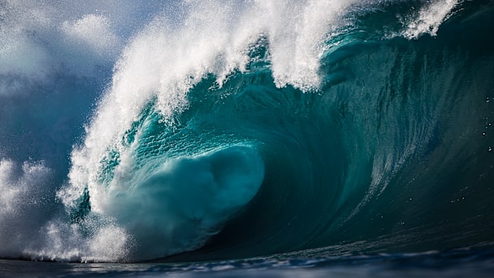
Most tsunamis go unnoticed. Defined as a wave caused by a disturbance like an earthquake, landslide, or volcanic eruption, tsunamis often reach just a few inches in height, according to NOAA. But when the inciting event is strong enough, the results can be disastrous. The most powerful tsunamis move as fast as jet planes across the open ocean and grow as tall as skyscrapers. When they reach land, they can decimate entire towns in minutes.
The tsunamis on this list aren’t necessarily the deadliest or most destructive, but they do dominate one category: sheer magnitude. Here are the tallest megatsunamis ever recorded.
- Karrat Fjord, Greenland // 295 Feet
- Ambon Island, Indonesia // 328 Feet
- Lituya Bay, Alaska // 394 Feet
- Lituya Bay, Alaska // 490 Feet
- Icy Bay, Alaska // 633 Feet
- Vajont Dam, Italy // 771 Feet
- Mount St. Helens, Washington // 820 Feet
- Lituya Bay, Alaska // 1720 Feet
Karrat Fjord, Greenland // 295 Feet
Greenland rarely sees tsunamis, but it was hit by one of the biggest waves on record in 2017. A landslide on Karrat Fjord sent a 295-foot-tall wall of water into the fishing village of Nuugaatsiaq on June 17. The megatsunami killed four people and swept 11 buildings into the ocean. Experts believe the event was triggered by a warming climate thawing the glacial landscape. The mountains surrounding Karrat Fjord are still unstable, and an even bigger landslide-caused tsunami could be in Greenland's future.
Ambon Island, Indonesia // 328 Feet
The first megatsunami to be documented in detail in Indonesia remains one of the largest tsunamis on record. On February 17, 1674, an earthquake struck the Maluku Islands in the Banda Sea. The seismic event sent a massive wave crashing into Ambon Island, where it killed more than 2000 people. The water reached the top of the coastal hills on the Hitu Peninsula, indicating the tsunami peaked around 328 feet.
Lituya Bay, Alaska // 394 Feet

This megatsunami that hit the T-shaped fjord on the southeastern edge of Alaska was likely caused by a landslide. Tree ring counts show it occurring in late 1853 or early 1854, and trimlines [PDF] (the point in the valley where trees were wiped away) indicate a maximum height of 394 feet. Lituya Bay has been the site of multiple megastunamis throughout history. Its steep walls and proximity to the Fairweather fault line are a recipe for destructive waves.
Lituya Bay, Alaska // 490 Feet
Lituya Bay’s second-biggest tsunami on record hit on October 27, 1936. Eyewitnesses described three giant waves rolling in from Crillon Inlet one after the other at speeds around 22 mph. The largest wave topped out at around 490 feet. Experts still aren’t sure what caused the 1936 tsunami, but an underwater rockslide is one possible culprit.
Icy Bay, Alaska // 633 Feet
The remote fjord of Icy Bay, Alaska, saw a historic megatsunami on October 17, 2015. Following a landslide, the 633-foot wave cleared 8 square miles of forest from Wrangell St.-Elias National Park and Preserve. Fortunately, no humans were close enough to be impacted by the event. Like Lituya Bay, Icy Bay features steep walls carved out by a retreating glacier, which contributed to the tsunami’s intensity.
Vajont Dam, Italy // 771 Feet

Unlike other tsunamis on this list, this disaster was caused by humans. The construction of the Vajont dam in northern Italy—the highest dam of its kind at the time of completion in 1960—disturbed the surrounding landscape. The face of nearby Mount Toc showed signs of cracking early on, and on October 9, 1963, the entire slope crumbled into the reservoir below. The landslide triggered a tsunami that wiped out several villages in the Piave valley within 15 minutes. More than 2000 lives were claimed in the tragedy. Reaching 771 feet tall, the Vajont dam tsunami is among history’s biggest in addition to being one of the deadliest man-made environmental disasters ever.
Mount St. Helens, Washington // 820 Feet

The earthquake that caused the infamous Mount. St. Helens eruption in Washington on May 18, 1980, also resulted in a tsunami. When the quake struck, the north side of the volcano broke apart and fell into Spirit Lake. The landslide remains the largest on record, and the 820-foot tsunami that followed is the third-largest in history. It crashed into the side of Mount Margaret before splashing back down into the basin below.
Lituya Bay, Alaska // 1720 Feet
On July 9, 1958, Alaska’s Lituya Bay was hit by the largest megatsunami ever recorded. It occurred when a 7.8 magnitude earthquake struck the Fairweather fault, dislodging 90 million tons of rock into the bay. The wall of water this produced reached nearly 1720 feet in the air—which is higher than the Willis Tower in Chicago. Five people were killed by the wave, included three people on the shore of Khantaak Island at Yakutat Bay’s entrance and two people on a boat in Lituya Bay.
More Articles About Tsunamis:
A version of this story ran in 2021; it has been updated for 2025.
